On Air Now
Heart's Club Classics with Pandora Christie 7pm - 11pm
19 November 2024, 11:25

Where is it meant to snow this week and when will the snow stop? Here is the latest Met Office UK weather forecast for November.
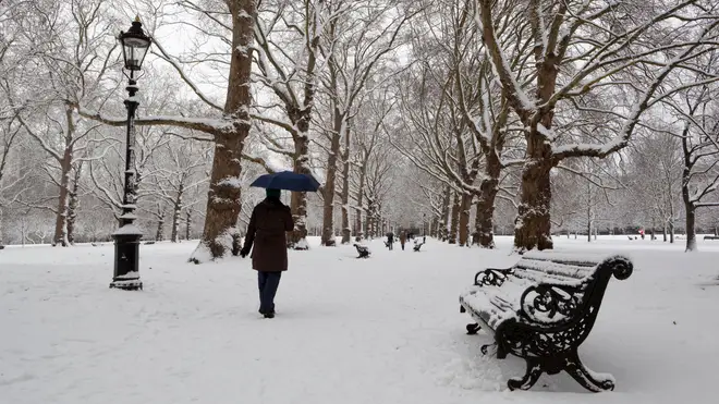
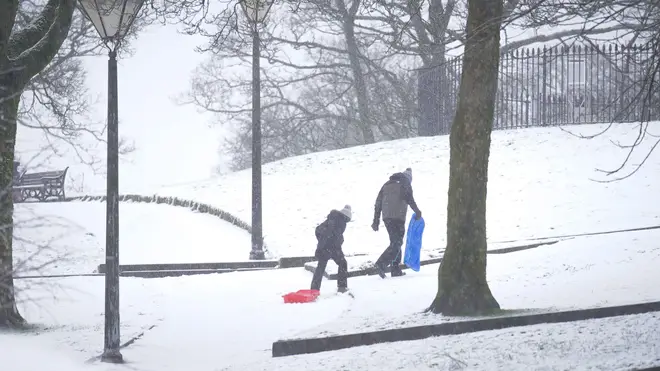
Snow and ice have made their way to the UK this week as temperatures continue to drop, leading to multiple school closures due to the frosty conditions.
November has brought wintery weather to the country, forcing the Met Office to issue yellow weather warnings in multiple locations across the country.
While temperatures plummet and we head further into winter, many of us have been wondering when the weather will change and if the snowy conditions will continue into next week.
Where is it meant to snow this week and when will the snow stop? Here is the latest Met Office forecast for November.

Lots of areas of the UK are expected to see snow and icy conditions from Tuesday, November 19th as wintery weather hits the country.
Scotland
Scotland is set to experience freezing temperatures, with Tuesday, November 19th and Wednesday, November 20th, seeing yellow weather warnings issued for both days.
The Met Office forecast for Tuesday and Wednesday state: "Snow and hail showers will affect northern parts of Scotland at times, becoming heavier and more frequent on Monday night, through much of Tuesday and then overnight into Wednesday morning.
"2 to 5 cm of snow is likely to accumulate quite widely, with up to 10 cm in some places by the end of Tuesday, and perhaps 15 to 20 cm accumulating above 300 metres.
"Showers may be sleety at times along north-facing coasts, although icy surfaces are likely at times."

Northern Ireland
The whole of Northern Ireland will be enveloped in snow and ice this week according to the Met Office.
Their forecast reads: "Wintry showers will develop during Tuesday evening and continue overnight into Wednesday morning.
"Away from the north coast lying snow is possible, with 1 to 2cm in places and up to 5cm over higher ground. Ice will readily form on untreated surfaces."

Wales
The frosty weather is set to continue into Wednesday for parts of northern and central Wales, as the Met Office reveal: "Snow showers will develop during Tuesday night and through Wednesday morning.
"Some lying snow is likely with 1-2 cm in places and a risk of up to 5 cm over higher ground. Ice will readily form on untreated surfaces."

Eastern England
It's set to become even colder in Eastern England, with The Met Office claiming: "Snow showers will develop during Tuesday evening and continue overnight into Wednesday morning, initially in the north of the area before spreading south later in the night.
"The showers may heavy at times and accompanied by lightning. Some lying snow is likely with 2-3 cm in places and a risk of 10 cm or more over higher ground. Ice will readily form on untreated surfaces."

Northern England and northern parts of the Midlands
Tuesday is set to be icy for Northern England and North Wales, as the Met Office write: "The most likely scenario is for most of the snow to accumulate on hills, with 5 to 10 cm possible above 200 metres and perhaps as much as 15 to 20 cm above 300 metres.
"Some snow will settle to lower levels, where 5 to 10 cm would prove much more disruptive - this remains uncertain, but seems most likely across parts of Yorkshire and Derbyshire.
"As rain, sleet and snow clear on Tuesday morning, icy stretches are are likely to form on untreated surfaces."

The Met Office predictions for the rest of the week states: "As that front clears on Tuesday, it leaves us with cold northerly winds, and things turn much colder for all areas across the UK for the rest of the week.
"Daytime temperatures will be in the low single figures for most, potentially slightly less cold in the far south, though sub-zero wind chill is likely.
"Despite the cold temperatures, there will be a good deal of sunshine away from the wintry showers near the coasts.Further snow accumulations are expected across the week, mostly by night at low levels, in northern Scotland and exposed parts elsewhere.
"There remains a small possibility of a more organised band of rain or snow affecting the far south west through Thursday as a larger system runs into the continent, though most models suggest this keeping to the English Channel."

However things are set to perk up at the weekend, with the Met Office stating: "As we head towards the end of the week, it looks like there will be an upswing in temperatures, with things turning milder, wetter, and possibly much windier for the weekend."