On Air Now
The EE Official Big Top 40 from Global 4pm - 7pm
1 November 2023, 13:18 | Updated: 1 November 2023, 13:20
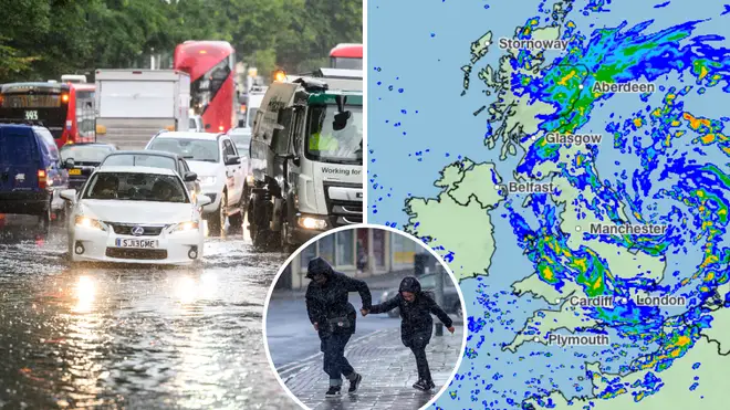


A weather tracker reveals when Storm Ciarán will hit each area of the UK.
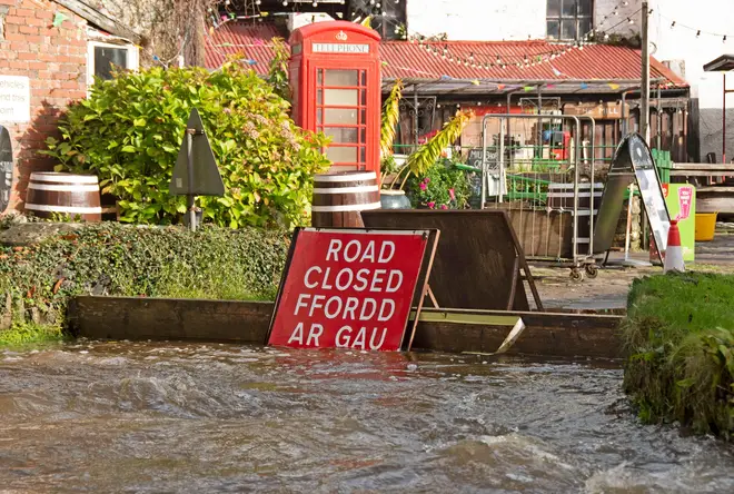
Storm Ciarán is set to bring heavy rain and strong wind over the next two days, with the South of England's coastal areas expected to see the worst weather conditions.
At the moment, there are yellow and amber weather warnings in place over Wednesday and Thursday, with gusts of up to 85mph in the most exposed locations.
According to the Met Office, further updates and additions are expected throughout the week as Storm Ciarán moves closer to the UK.
Chief Meteorologist Dan Suri said in a weather forecast on Tuesday, 31st October: “Tomorrow, ahead of Storm Ciarán, a squally cold front will move eastwards across southern and southeast England bringing bursts of heavy rain and coastal gusts of 60-70mph, mainly from Dorset eastwards.
“Wind and rain warnings associated with Storm Ciarán are in force from Wednesday night onwards into Friday, with further updates possible on Wednesday.
"These include amber warning for winds for southwestern parts of England and Wales Thursday early hours and morning and the far south and southeast of England Thursday daytime and early evening."
He added that as well as strong winds, the "deep low pressure system" will bring heavy rain to many parts of the UK.
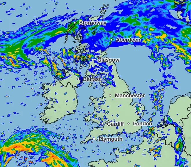
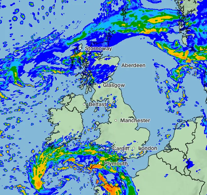
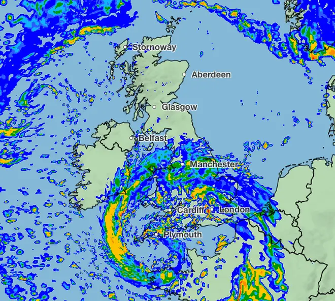
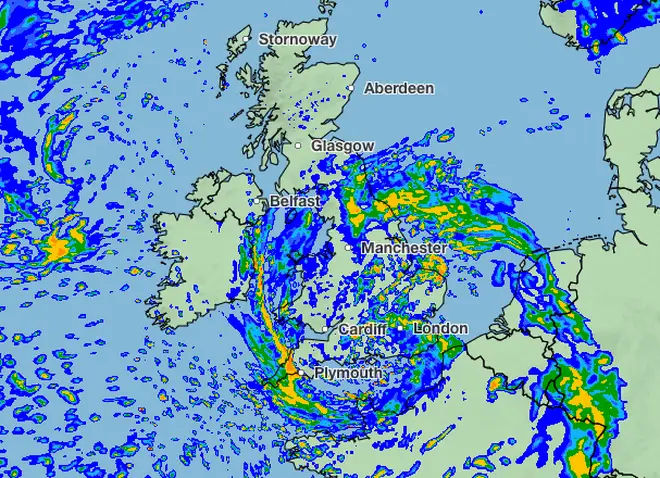
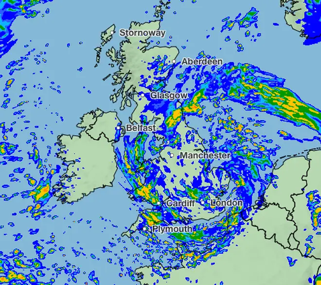
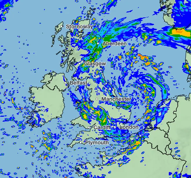
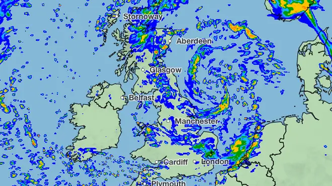
This is the journey Storm Ciarán is expected to make from Wednesday to Friday this week.
Wednesday, 1st November, 3:00PM
Wednesday, 1st November, 8:00PM
Thursday, 2nd November, 2:00AM
Thursday, 2nd November, 6:00AM
Thursday, 2nd November, 11:00AM
Thursday, 2nd November, 4:00PM
Thursday, 2nd November, 10:00PM
Wednesday, 1st November - Yellow Weather Warning
Thursday, 2nd November - Amber & Yellow Weather Warning


