New maps show exact date 33C Mediterranean heat blast to hit Britain
25 July 2024, 12:07


Despite the grey weather outside, we are set to see an August heatwave very soon...
Listen to this article
Loading audio...
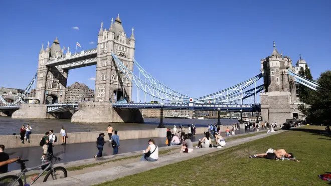
New weather maps have revealed the UK is set to see temperatures of 31C in the coming weeks, as a fresh heatwave hits our shores.
According to Netweather and WXCharts, the 8th of August will bring scorching temperatures to parts of the UK, as the European heatwave continues.
London is expected to see the majority of the heat, however areas such as the north east of England are predicted to reach 25C, while Scotland could see highs of 21C.
- Listen on Global Player, the official Heart App: The Sports Agents with Gabby Logan and Mark Chapman
The Express report that this warm air will be coming from France, as the country sees its weather heat up to a whopping 33C.
The Met Office have given their verdict about what we can expect at the beginning of August, with their forecast stating: "No single weather type is expected to dominate through this period.
"Some spells of dry, settled weather will likely alternate with wetter, cloudier conditions at times.
"The wettest conditions will probably be in the northwest, with the southeast tending to be driest. Through the period as a whole, warmer than average conditions are more probable, perhaps with some short-lived hot spells."
- Read more: Is it too hot to walk your dog and can you give your pooch ice cubes to cool them down?
- Read more: What should I do if I see a dog locked in a hot car?

This comes after the UK experienced a chilly summer, with low temperatures in both June and July.
Meteorologist Alex Deakin revealed that a powerful jet stream has had an impact on the warm weather, continued: "The jet stream has set up this pressure pattern that allows the winds at the surface to come down from the north and bring us the Arctic air."
Speaking at the beginning of June, Mr Deakin added: "What we’ve had for this week is a high pressure [system] out to the west, where the winds are going round clockwise, and low pressure out to the east, where the winds are going around anticlockwise, and we’re in between the two, and that’s been drawing down the northerly."
- Read more: Seven tips to keep cool at night without a fan during the heatwave
- Read more: The two-second fan trick that could help you sleep during the heatwave
- Read more: Restaurants and cafés where kids eat for free this summer school holiday


