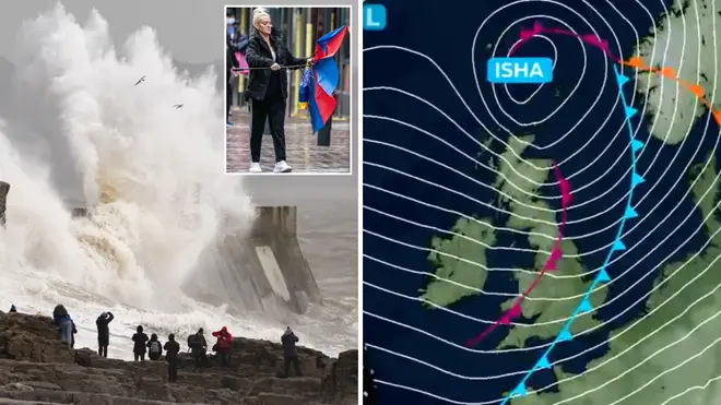
Storm Isha details: How long will it last and why is it called Storm Isha?
22 January 2024, 08:53 | Updated: 22 January 2024, 08:59

How long will Storm Isha last and what is the meaning behind the Met Office name?
Listen to this article
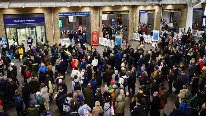
Storm Isha has caused chaos and disruptions across the UK over the weekend, with heavy rain and strong winds causing the Met Office to put several weather warnings in place.
On Sunday evening, wind speeds reached as high as 99mph as the weather system cause rail, sea and air disruptions.
Power cuts were also rife across Northern Ireland, the North-West of England and Wales and Cornwall with as many as 56,000 losing power.
As Storm Isha continues to cause delays and disruptions to UK residents, here's all the details you need to know.

Why is it called Storm Isha?
Storm Isha was named by the Met Office on Friday 29th January 2024.
The Met Office name storms as it makes it easier for meteorologists and the public to communicate over the storm. This tradition comes from World War II and was later adopted by all regions.
The storms are named in alphabetical order and it is believed most regions across the world have pre-determined names for upcoming storms.
Storm Isha is the ninth storm of the winter season (which starts in September), which means it is named with the ninth letter in the alphabet.
It is unknown why specific names are chosen, but the name origin of Isha is Hindu and means "one who protects."
How long will Storm Isha last?
Storm Isha is expected to have cleared the UK on Monday evening and into Tuesday morning with the weekend having brought the worst of the rain and wind.
There will be a second weather system arriving following the departure of Storm Isha however, brining wet and windy weather on Tuesday.
Heavy rain is expected in some northern areas following Storm Isha, which the Met Office have warned could exacerbate some of the flooding impacts.
Strong winds will stick around on Tuesday and Wednesday, with above average temperatures of up to 14C in some areas.

Where is Storm Isha coming from?
The Met Office report that Storm Isha has been caused by the cold Artic air across the UK subsiding and being replaced by an Atlantic influence. This Atlantic influence brings mild conditions for the UK as well as wet and windy weather.
Chief Meteorologist, Dan Suri, said: “Storm Isha will bring strong winds to the whole of the UK through Sunday and into Monday. The areas of particular concern are reflected by a large Amber severe weather warning which covers Northern Ireland, central and southern Scotland, Wales, much of northern England as well as southwestern parts of England.
“In these regions we could see gusts frequently between 50-60mph and even up to 80mph in exposed coastal locations. As the storm starts to move away on Monday morning very strong winds will also develop in the far southeast of England, bringing the risk of 70-80mph gusts here too in the early hours of Monday morning."
He added: “Storm Isha will bring a disruptive spell of weather to the UK with strong winds across the whole country. Heavy rain will cause additional hazards, particularly in the west. A number of severe weather warnings for rain have also been issued. Keep up to date with the Met Office warnings and pay close attention to guidance from your local authority.”
What is Storm Isha's wind speed?
Storm Isha's wind speed reached 99mph in some areas on Sunday evening, causing power cuts, train and flight disruptions and road closures.
The wind will not be as strong on Monday, but blustery showers and rain is expected.
Read more:
- Storm Isha: Travel disruption to continue after UK battered by danger-to-life winds
- Met Office makes rare move issuing amber wind alert for almost whole of Britain and Northern Ireland
- Storm Isha UK tracker map: Where and when will storm hit?


