On Air Now
Heart Breakfast with JK and Amanda Holden 6:30am - 10am
17 July 2020, 08:27 | Updated: 17 July 2020, 08:30

The new map will show people in England their local COVID-19 data.
You can now find out how many people in your local area have tested positive for coronavirus.
A new interactive map released by the Government will show people in England the COVID-19 data in their postcode.
The data is said to be updated weekly, but the aim is to have the figures being updated daily.
READ MORE: Is a skin rash a coronavirus symptom and will it be added to NHS guidelines?

While the map will not reveal addresses or details of people who have previously had or have the virus, you will be able to get an idea of the figures in your area.
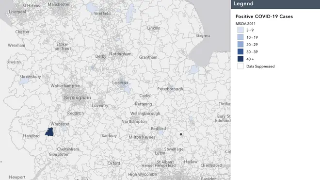
While there is no data for a lot of areas across England yet, the shades of blue on the map will show how many cases of COVID-19 there are in a certain postcode.

The numbers range from 3-9 cases, to a dark blue which marks over 40 cases.
The white areas on the map have had 'data suppressed'.
For example, this week's data shows that in Colwall, Cradley & Wellington Heath, there are 68 confirmed cases of the virus.

This new map comes after Leicester was put on a local lockdown due to a spike in COVID-19 cases.
The area went into a local lockdown two weeks ago, forcing non-essential shops, hairdressers, garden centres and more to close, while the rest of England continued to take steps out of lockdown.
This week, Matt Hancock announced that lockdown for Leicester would not be lifted, but some restrictions eased.
READ NOW: How long will the Leicester lockdown last and what are the rules?