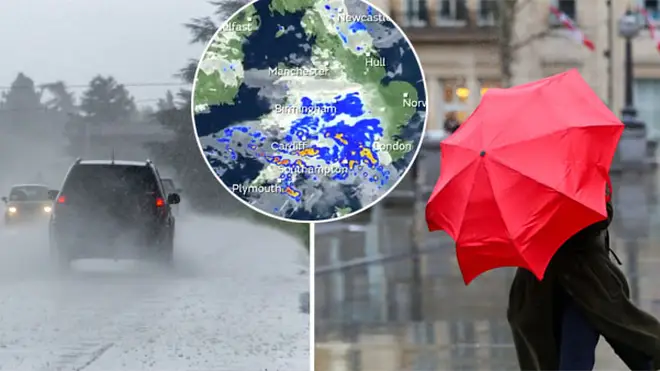
UK weather: Travel chaos as 60mph winds set to batter Britain in Storm Francis
24 August 2020, 11:01 | Updated: 24 August 2020, 11:10

The Met Office has warned Storm Francis will bring 60mph winds this week.
The weather in the UK will take a turn for the worse this week, as things get very wet and windy for most of England and Wales.
In fact, the Met Office has now named the latest bad weather 'Storm Francis' with a yellow warning issued from 9am on Tuesday morning until midday on Wednesday.
A tweet from their official Twitter account reads: "#StormFrancis has been named
"A deep area of low pressure will bring heavy rain and the risk of severe gales in places during Tuesday and Wednesday. Warnings have been issued."
#StormFrancis has been named
— Met Office (@metoffice) August 24, 2020
A deep area of low pressure will bring heavy rain and the risk of severe gales in places during Tuesday and Wednesday
Warnings have been issued, more information here https://t.co/vdbKXpnseG
stay #WeatherAware pic.twitter.com/UZk11JB7s8
The spell of ‘Canadian Vortex’ winds will start out across the South West of England tomorrow morning, before spreading east across other parts of England and Wales overnight.
Read More: Mum shares simple hack to slow down speedy Aldi checkout staff if you can't keep up
A spokesperson has said: "A spell of strong winds is likely to develop across the southwest of England and Wales on Tuesday morning, before spreading east across other parts of England and Wales overnight, clearing into the North Sea on Wednesday.
“Gusts of wind are likely to exceed 50 mph for quite a few places, with exposed coasts and hills seeing gusts in excess of 60 mph.

Dr Hilary issues warning over airport coronavirus testing
“Whilst not exceptional, winds this strong are unusual for August and they will be accompanied by some heavy rain in places, with possible transport disruption and impacts on outdoor activities."
Speaking to The Mirror, MeteoGroup even said the winds will affect even more areas than Storm Ellen.
Forecaster Paul Mott said: "Peak wind gust speeds similar to Ellen are a risk, with 60mph or a bit higher possible in the West.
"The low pressure is coming from just south of Newfoundland. It will be an unpleasant couple of days when it arrives."

Dr Hilary demonstrates how the new coronavirus antibody test works
The Environment Agency has also warned of more floods in the north ahead of the Bank Holiday weekend.
On Tuesday and into Wednesday morning 20-40mm of rain will fall, while upland areas could see more like 60mm fall.
While the strong winds and rain will continue into Wednesday, things are set to improve throughout the day, with sunshine towards the end of the week.
Now Read: Newly-discovered rare Shakespeare £2 error coin sells for impressive £230 on eBay


